

This repository contains the data and scripts that maintain and build the dcw-gmt package used by GMT 5 or later. Note: DCW 2.0.1 requires GMT 6.1.1 or later. Building the DCW netCDF database requires the netCDF executables ncgen and nccopy, usually available in a port called netcdf-bin or similar (i.e, separate from the netCDF library).
This README contains the documentation for DCW. For information about building and modifying DCW, please refer to the contributing guide.
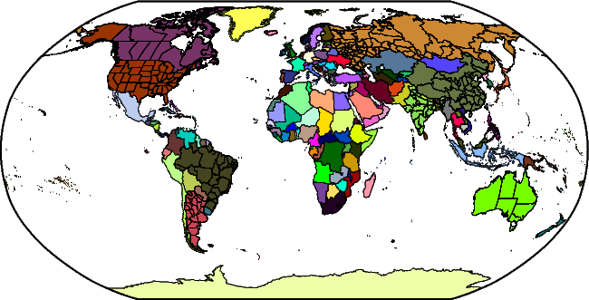
The Digital Chart of the World is a comprehensive 1:1,000,000 scale vector basemap of the world. The charts were designed to meet the needs of pilots and air crews in medium- and low-altitude en route navigation and to support military operational planning, intelligence briefings, and other needs. For basic background information about DCW, see the Wikipedia entry.
DCW-GMT is an enhancement to DCW in a few ways:
- It contains more state boundaries (the largest 8 countries and Norway are now represented).
- The data have been reformatted to save space and are distributed as a single deflated netCDF-4 file.
You can download the latest dcw-gmt package from GitHub releases or from the GMT main site.
DCW-GMT is an optional install for GMT and its wrappers. If you did install it then you can access the DCW data for plotting or analysis via GMT's coast module. You can also use the ISO 2-character codes for countries as a way to specify map domains via the -R option. For instance, to make a map showing France with a region rounded to the nearest 2 degrees in longitude and latitude, you can run:
gmt coast -RFR+r2 -Glightgray -B -pdf france
If in addition you want to paint the landmass of France blue, you can run:
gmt coast -RFR+r2 -Glightgray -B -EFR+gblue -pdf france
To access states without countries you must use the country.state syntax. See the coast documentation for details. For instance, to make a map of the US and show Texas and Mississippi as red states, try:
gmt coast -RUS+r2 -Glightgray -B -EUS.TX,US.MS+gred -pdf us
From versions 2.1.0 and GMT 6.4.0 onwards you can also use named regions (continents, seas, etc) using their names. We offer 37 geographic regions based on Natural Earth at scale 1:110, 104 seas named (102 based on IHO1953, most of them taken from Fourcy and Lorvelec (2013)) and 57 lakes, islands and archipelagoes. You can also use 46 collections of countries; 30 are from UN49 and the rest were obtained from from Wikipedia. You can see the full list at dcw-collections.txt. These allow you to make maps matching those regions, such as
gmt coast -RScandinavia -Glightgray -B -pdf Scandinavia
gmt coast -RIHO28 -Glightgray -B -pdf MediterraneanSea
gmt coast -RSAM -Glightgray -B -pdf SouthAmerica
gmt coast -RHMLY -Glightgray -B -pdf Himalayas
If you are building GMT from source then you should set the parameter DCW_ROOT in the cmake/ConfigUser.cmake to point to the directory where dcw-gmt.nc has been placed. If you add this file after GMT installation was completed then you can always have GMT find it by placing it in your user ~/.gmt directory or by setting the DIR_DCW parameter in the gmt.conf settings.
The detailed changelog is available here.
The project is distributed under the GNU Lesser General Public License.